Log in
All resources
Create a design
140 Free Artworks of Iberian Peninsula
bibliothèque nationale de france
maps in the rijksmuseum amsterdam
regnorum hispaniae nova descriptio (blaeu)
spain in the 1640s
maps of spain by tomas lopez
map collection of leibniz-institut für länderkunde
maps
18th-century maps of the iberian peninsula
18th-century maps of spain
18th-century maps of portugal
cartography
maps
1810s maps of the iberian peninsula
maps of spain by tomas lopez
regnorum hispaniae nova descriptio (blaeu)
bibliothèque nationale de france
flower
botany
maps of the iberian peninsula by mercator-hondius
maps by pieter van der keere
regnorum hispaniae nova descriptio (blaeu)
spain in the 1640s
regnorum hispaniae nova descriptio (blaeu)
spain in the 1640s
regnorum hispaniae nova descriptio (blaeu)
spain in the 1640s
regnorum hispaniae nova descriptio (blaeu)
spain in the 1640s
regnorum hispaniae nova descriptio (blaeu)
spain in the 1640s
regnorum hispaniae nova descriptio (blaeu)
spain in the 1640s
1810s maps of the iberian peninsula
a system of modern geography (1810)
atlas géographique des quatre parties du monde (delisle)
18th-century maps of the iberian peninsula
map collection of leibniz-institut für länderkunde
maps of spain by tomas lopez
map collection of leibniz-institut für länderkunde
maps of spain by tomas lopez
maps by jean-baptiste bourguignon d'anville
old maps of roman hispania
map collection of leibniz-institut für länderkunde
1690s maps of the iberian peninsula
17th-century maps of the iberian peninsula
description de l'universe
context files from gallica
history of spain
17th-century maps of the iberian peninsula
description de l'universe
map collection of leibniz-institut für länderkunde
maps of spain by tomas lopez
les monts pyrénées, où sont remarques les passages de france en espagne dressé sur les mémoires les plus nouveaux - par le sr. sanson... - btv1b532269750
1688 maps of europe
map collection of leibniz-institut für länderkunde
1720s maps of the iberian peninsula
17th-century maps of the iberian peninsula
description de l'universe
1800s maps of the iberian peninsula
maps by john cary
maps of portugal by fernando álvares seco
maps
1810s maps of the iberian peninsula
1813 maps of spain
18th-century maps of the iberian peninsula
maps in the rijksmuseum amsterdam
maps in the rijksmuseum amsterdam
johannes leupenius
1610s maps of the iberian peninsula
maps by jodocus hondius
1640s maps of the iberian peninsula
maps in the rijksmuseum amsterdam
maps by jodocus hondius
1610 maps of europe
18th-century maps of the iberian peninsula
maps in the rijksmuseum amsterdam
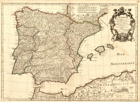
maps of the iberian peninsula by guillaume delisle
maps in the rijksmuseum amsterdam
prints by jan luyken in the rijksmuseum amsterdam
maps in the rijksmuseum amsterdam
maps of the iberian peninsula by guillaume delisle
1700s maps of the iberian peninsula
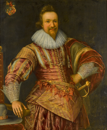
17th-century portraits with coat of arms
franz kessler
maps in the rijksmuseum amsterdam
maps by frederick de wit
franz kessler
les forces de l'europe, asie, afrique et amerique, ou description des principales villes, avec leurs fortifications
1702 maps of spain
101 - 140 of 140
/ 2